
Within the Urban ReLeaf, CLS (Collecte Localisation Satellites) has been developing high-resolution tree canopy maps to support urban planning and environmental monitoring. These datasets provide detailed information on the location and extent of trees across pilot cities, including Athens, helping local authorities better understand and manage their urban green infrastructure.
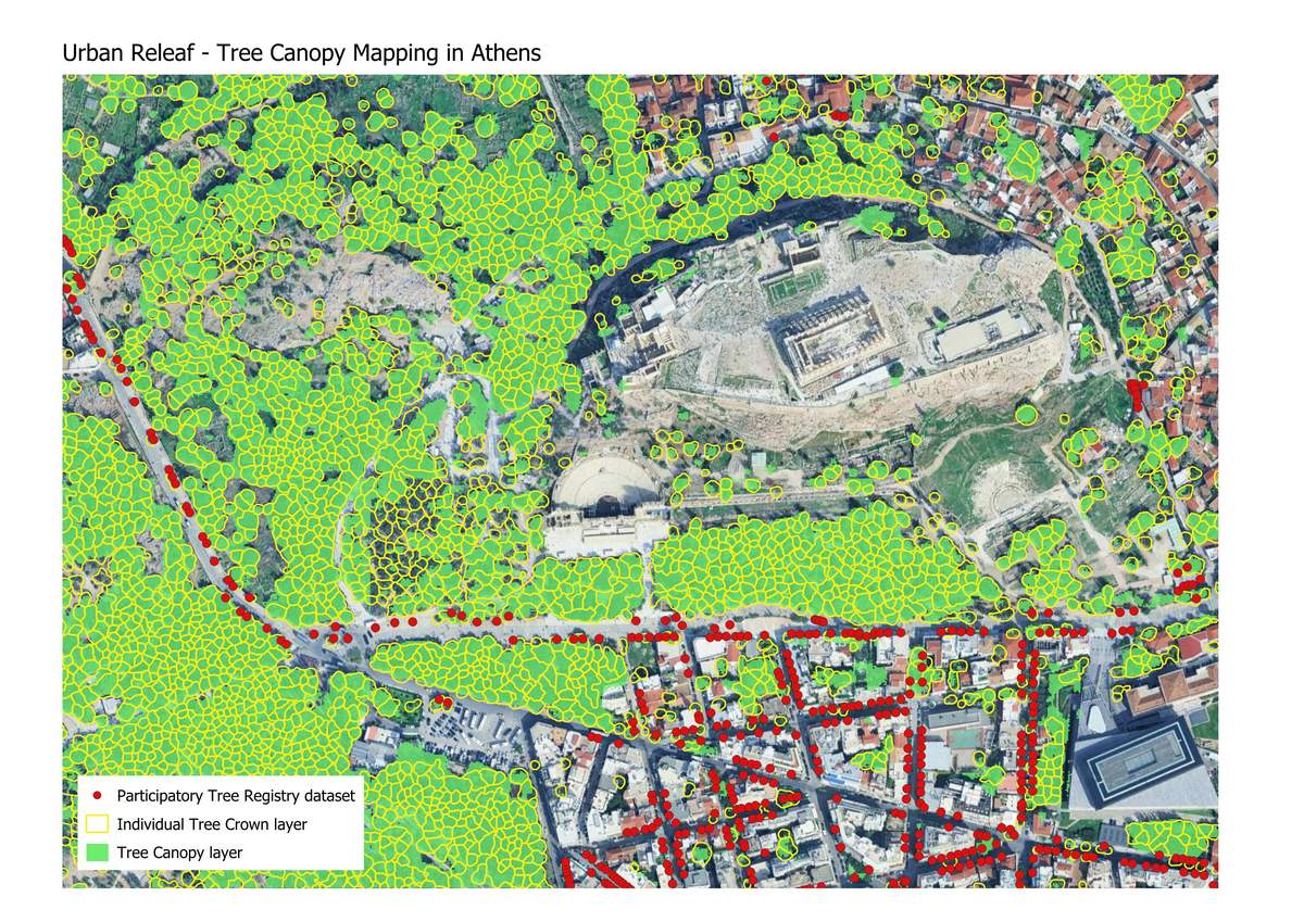
The mapping approach combines Earth Observation data with advanced image analysis techniques to produce two complementary products: a Tree Canopy layer, which identifies areas covered by woody vegetation, and an Individual Tree Crown layer, which delineates single trees with high precision.
Recent work has also explored the integration of citizen-generated information, such as Participatory Tree Registry datasets implemented in Athens and Mannheim. Results show that local tree inventories can significantly improve the completeness and accuracy of tree mapping products, although their spatial coverage often remains limited (along narrow streets for example). Combining citizen data with satellite-based observations therefore offers a promising path toward more comprehensive urban tree monitoring.
Accurate tree canopy information is becoming increasingly important for tracking progress toward European policy objectives. For example, the EU Nature Restoration Regulation calls for no net loss of urban tree canopy cover by 2030 and an increasing trend thereafter, while the EU Biodiversity Strategy targets the planting of three billion additional trees by 2030. Tree canopy datasets can therefore support widely the monitoring of these regulations.
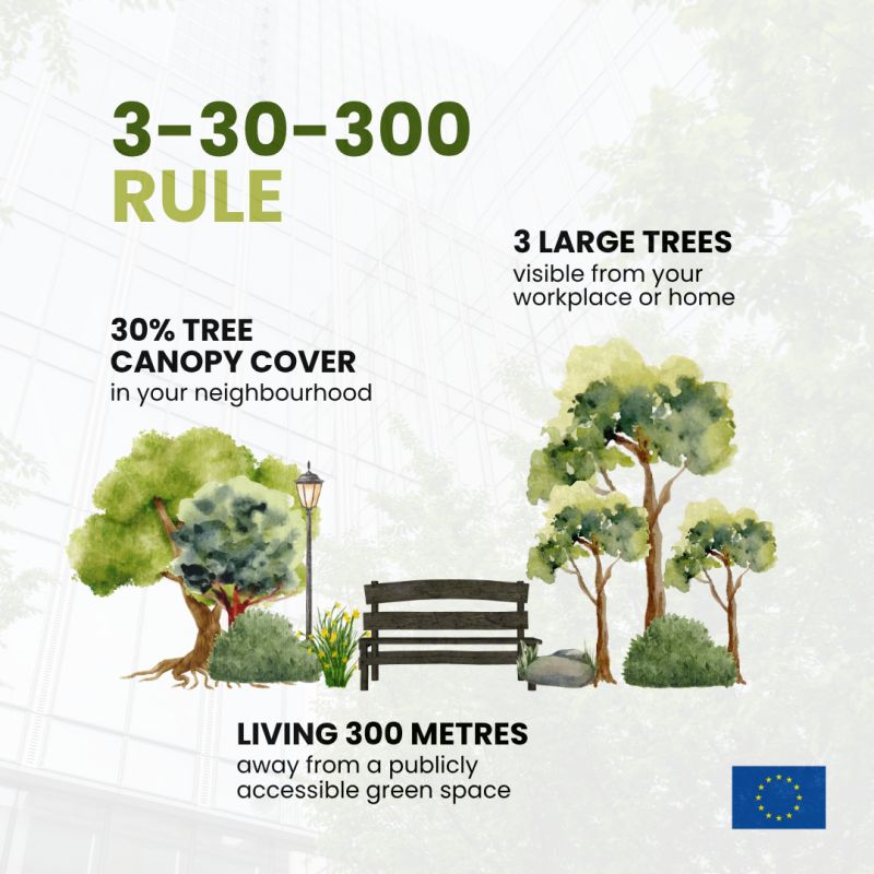
Beyond regulatory reporting, tree canopy mapping can support the implementation of the widely recognized 3-30-300 rule, a science-based framework for healthier urban living. The rule recommends that every resident should be able to see at least 3 trees from their home, live in neighbourhoods with at least 30% tree canopy cover, and have access to a quality green space within 300 metres.
This indicator has been calculated on each pilot city of Urban Releaf project and highlights the number of buildings reaching 1, 2 or 3 components of the 3/30/300 rule. An example in Athens is showcase in the figure below.
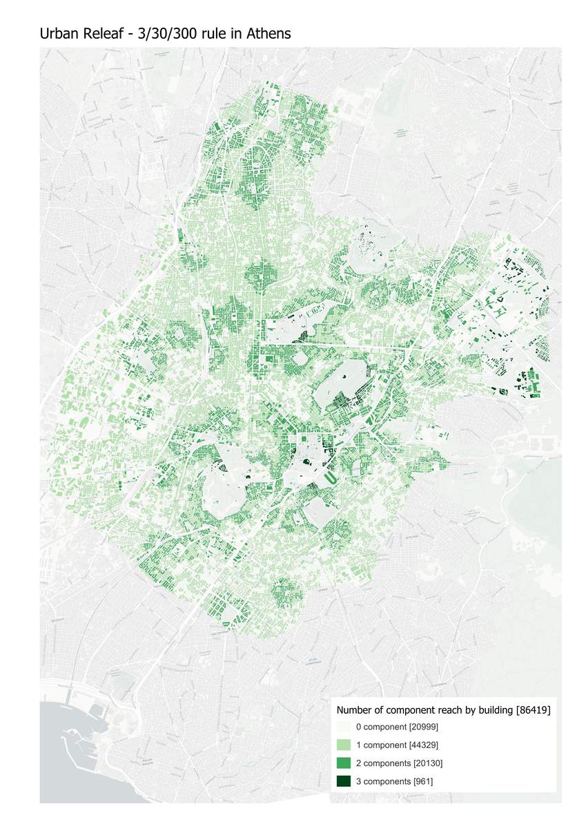
By providing accurate and spatially consistent information on urban tree cover, tree canopy datasets enable cities to measure these indicators, identify underserved areas, and prioritize greening actions where they are needed most. As a result, municipalities can better target investments that improve thermal comfort, public health, biodiversity, and overall quality of life while ensuring equitable access to urban nature.