What if city planners could test urban design scenarios before breaking ground?
Utrecht’s Digital Twin is making this a reality, as we discovered at the recent Urban ReLeaf General Assembly in Cascais.
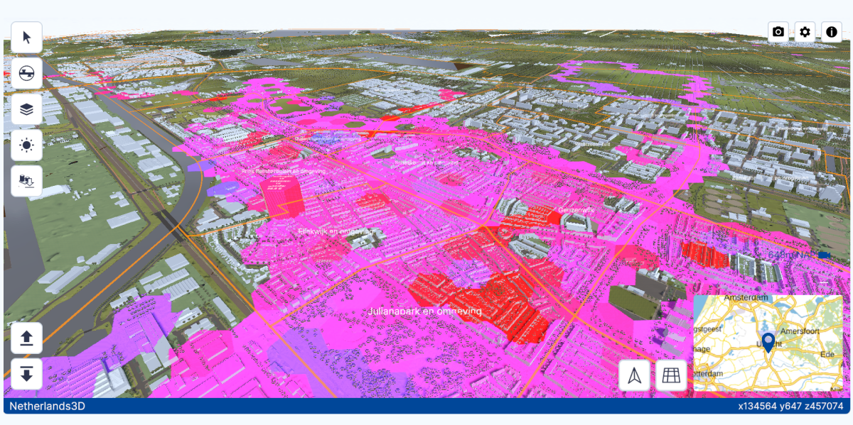
Utrecht Urban Planning and Development
What is Utrecht’s Digital Twin?
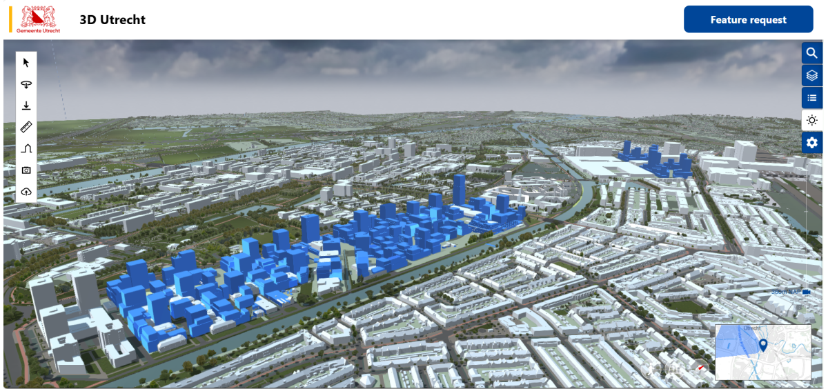
The Utrecht Digital Twin is an interactive 3D model that captures everything from buildings and parks to underground infrastructure. It’s a living data platform where city officials, researchers, and residents are collaborating to visualise changes and assess environmental impacts before implementation.
Annemarie Derksen, team manager of Urban Design at the Municipality of Utrecht, explains,
“The digital twin is a great tool to dive into the DNA of your city and see the impact of your plans in advance”.
Built Through Collaboration
This innovation emerges from a powerful partnership network:
- Municipality of Utrecht – Leading the initiative to improve urban planning, sustainability, and infrastructure management, in collaboration with Amsterdam and the provinces of Flevoland and Utrecht.
- Knowledge institutions – Delft University of Technology and the Dutch Cadastre, Land Registry, and Mapping Agency contribute expertise in digital modelling and urban analysis.
- Private sector & technology companies – Engineering firms and game developers like Unity provide technical support and infrastructure solutions.
- Local communities & residents – As part of the Urban ReLeaf project, residents from four neighbourhoods have contributed climate data, helping to map temperature variations, humidity levels, and heat hotspots.
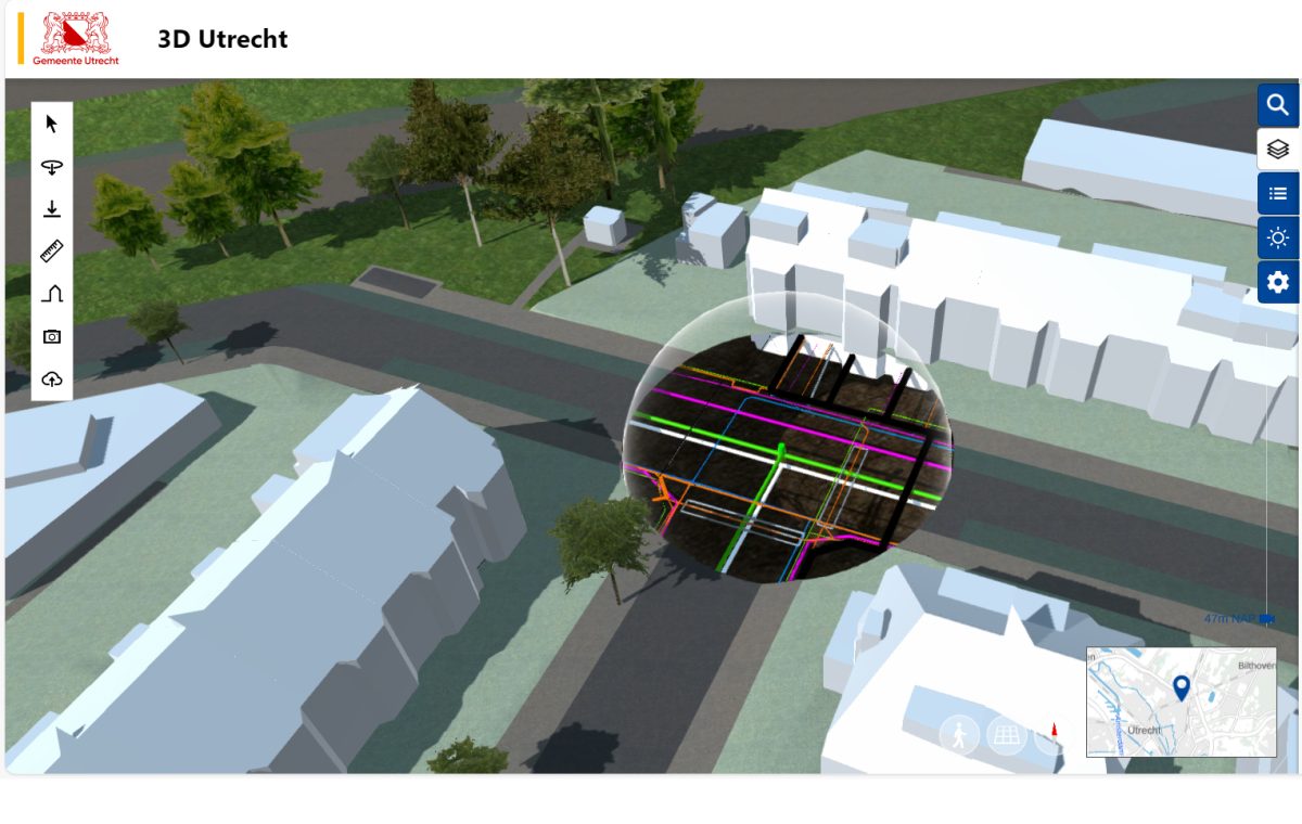
Utrecht digital twin showing underground infrastructure
Real world benefits
Originally designed for urban planning, the Digital Twin now delivers:
- 30% faster decision-making on infrastructure projects
- Visualisation of 12 climate adaptation scenarios for heat island mitigation
- Engagement from over 200 community members contributing localised data
The platform bridges the reality of above and below-ground infrastructure, connecting underground utilities with surface development plans, a challenge that previously created costly planning delays.
From Data to Action
Utrecht has already integrated the Digital Twin into several projects. The neighbourhood climate data collected through Urban ReLeaf appears directly in the model, creating Utrecht’s first comprehensive heat map and climate adaptation planning. Additionally, the model connects above ground plans with below ground constraints by linking 3D underground data with urban development. This isn’t just data collection, it’s informing where the city plants trees, installs cooling infrastructure, and prioritising green space development.
The Twin4Resilience initiative is also enhancing the skills of urban planners, equipping them with the ability to use 3D visualisation for improved decision-making. The municipality is preparing for a broader transition to digital spatial planning.
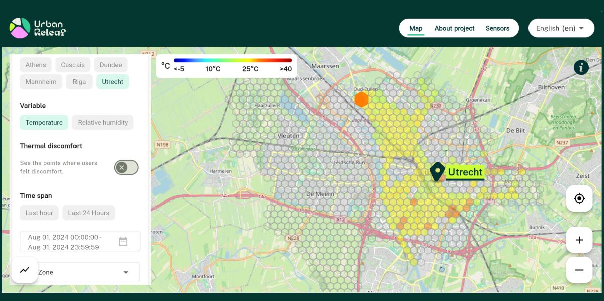
Urban ReLeaf data visualisation platform
Explore Utrecht’s Digital Twin
The Digital Twin of Utrecht is continuously evolving, with new data and applications being integrated.
Want to see it yourself? Check out:
Utrecht is both streamlining planning as well as creating pathways for citizens to actively shape their urban environment while driving climate resilience forward.